Friday 17 February 2017

Wairarapa


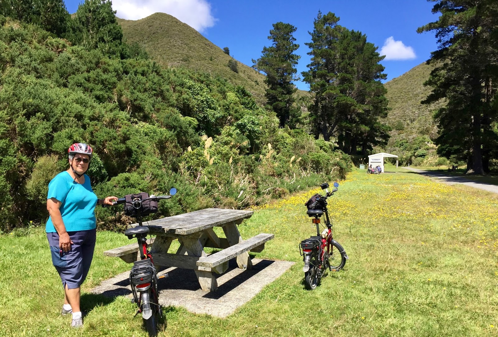
Since I made a careless statement in my last blog post about possibly riding the whole of the Rimutaka Rail Trail some time, John has been agitating for us to do just that. So the night before last, with a fine day forecast, we agreed to give it a go yesterday (15 February).

What we couldn’t agree on was the direction in which to do it. Part of the reason was the logistics of getting to the start and getting home at the end. The Wairarapa train line is a commuter service, allowing local residents to get into Wellington in the morning and home again at night. So there are very few choices.

One option was to take an early train from Petone to Maymorn, ride the Rimutaka trail, over the top, down the Wairarapa side, bike 12 km to Featherston, and take the late afternoon train back from there. This would mean an easy ride to the top, and a steep one down to Cross Creek. This was my preferred way.

The other option, which John preferred, was to take the early train to Featherston, bike to Cross Creek, ride the trail from the Wairarapa side, with the steep (but shorter) bit first, and then an easy ride back from the Summit, and take the train back from Upper Hutt. This had two advantages: the prevailing wind would be behind us; and we would end up in Upper Hutt, from where we could take a Hutt Valley train, which has services every half hour rather than just a couple at the end of the day. But I balked at the idea of having to do the steep bit, having to walk and push the bikes uphill at Siberia.

In the end we compromised, and scrapped the idea of using the train. We would go on a “recce” (reconnoitre) first. We’d drive to Featherston, and on to Cross Creek, bike up the steep start of the track from there, see how bad Siberia was, and go back. Then we would go to Greytown and ride the easy Woodside trail loop.

But it all panned out quite differently.

After coffee at Featherston’s Everest Café, we headed out towards Cross Creek on Western Lake Road. We noticed that there was a dedicated, unsealed (lime sand?) bike track alongside the road. It had to divert onto the road every time there was a one-lane bridge over a stream, and there were many. But at each bridge there was a warning to the cyclists to “give way to oncoming road traffic”. For the motorists, there were signs well ahead of each bridge, warning them to “Watch for cyclists”. But we didn’t see any cyclists at all.

It is just over 10 km to Cross Creek, but we overshot the turn-off. When we realised that we’d missed the turn-off, we decided to keep going down to the coast, to see what the other end of the Rimutaka Cycle Trail was like. 

It was a long way, 36 km from Cross Creek to Ocean Beach. But the road is good, and some of the scenery is very pretty. Part of it skirts along Lake Wairarapa, which actually does not look very inviting, as it is brown, and surrounded by flat land.

Eventually we got a view of the sea, the road changed to gravel, and we came to a sign saying “Grader working next 5 km”. Down a steep gravel road, Ocean Beach Road, all bumpy corrugations from the grader’s metal caterpillar tracks. Across a bridge – a short bit of sealed road – then onto more gravel road. The grader moved out of the way to let us and another car go past, and along to a rough stony area to park.

It is a beautiful, wild coast, and I just wanted to have a look, maybe go for a short walk, take some photos, then turn around and go back, but John was determined that we should bike some of the Ocean Beach Road. Aargh!

I just wanted to look and take photos, but John was determined to go for a ride

While we were getting the bikes ready, the grader went past and headed down the road. So we had to carefully pick our way on the freshly graded surface. The grader had stirred up the gravel, and left corrugated tracks and strips of gravel and soft sand that you had to negotiate getting across to get from one solid surface to another, if it became too stony. I must admit I didn’t much enjoy it.

The graded surface of the road was not nice to bike on (photo by John)

Luckily we didn’t go very far, as the road went through a stream. Not that it was deep or scary, but that sort of terrain is for young and fit people riding well-sprung bikes with big, fat wheels – not for the grey and clumsy on folding bikes with small wheels. And we preferred to keep our feet dry.

The grader had gone beyond the stream (photo by John)

We stopped short of the stream, and clambered up a narrow track that led to a wooden platform, that seemed to have no other purpose than as a lookout and place to take photos from.

We stopped short of the stream and left the bikes …

… and clambered up a short track

The view was certainly dramatic and expansive. Ahead was Palliser Bay, stretching from Cape Palliser on the left, to the Wainuiomata Coast on the right. Looking inland was the wide, shambling valley of a small stream – the Wharekauhau Stream – with some impressive looking cliffs. John remembers investigating the geology of these cliffs with a School of Earth Sciences student some years ago.

Looking towards Cape Palliser (photo by John)

The Rimutaka Cycle Trail follows this coast towards Wainuiomata (photo by John)

The Wharekauhau Stream has a wide riverbed, but not much water at this time of year
(photo by John)

As we were heading back, and I was crossing from one track into another, I skidded in a patch of soft sand. I could feel my front wheel slipping sideways out from under me, and I went sprawling! Full faceplant! When I managed to pick myself up, I was covered in grey dust, and had gravel embedded in my left knee and elbow, and in the heels of both my hands. I should have worn gloves!

I brushed myself down, after a fashion, and we continued on towards the bridge that we had crossed earlier, and took more photos. This river had more water in it, and also sported some interesting cliffs. On checking the map, we found this was the Wharepapa River.

Impressive cliffs and more water (photo by John)

On the bridge (photo by John)
The mouth of the Wharepapa Rver and view towards Palliser Bay

We came to a junction where the road changed its name. On the photo the sign pointing straight at me, said "To Wharekauhau". This is a very exclusive and expensive luxury retreat, where the likes of Prince William and other rich and famous people get to stay.

The sign to Wharekauhau is pointing straight at us

I thought I should have rocked up there and asked to use one of their bathrooms to clean myself up after my tumble. But that would have seriously lowered the tone of the place, wouldn’t it? So instead, we went back to the car, and I cleaned up my grazes as best I could with tissues and water from my drink bottle.

Clean-up time (photo by John)

Back on the road – in the car – back to Cross Creek. Despite my fall, we decided to check out the track at Cross Creek, since we were here. Somehow, the road back didn’t seem to take as long as it had on the way out. We stopped a few times for more photos.

Looking back towards Wharekauhau

The view down to Lake Onoke, and the bar that separates it from Palliser Bay
(click to enlarge) (photo by John)

We also stopped for a small herd of cattle – young steers, I think – being walked from one paddock to another.

Rural traffic jam (photo by John)

At the Cross Creek carpark, we talked to some people who had just come back from walking (the women) and cycling (the men) the Rimutaka Trail. They’d only gone a short distance, but they said it was very pretty, though quite narrow in places.

Well, we duly set off, and the very start was OK, but then the track became just a very narrow rut with grassy edges. I didn’t feel too comfortable about the drop to the right of us as we progressed, and I worried about John.

The track was narrow and became even narrower (photo by John)

I went ahead of John, and when I came to a spot where the track became very stony and looked like it had been, or was being, repaired, I waited for him to catch up. I wasn’t keen to continue. Having had one fall, I had no wish to take another spill, nor did I want to push my bike over rough ground.

John took a while to catch up – and he was walking! “Let’s call a stop to this”, he said. The narrowness of the track, and the drop to the right in some places were “messing with his balance”. Wearing his eyepatch, he has no peripheral vision to his right, so a drop on the right hand side of a narrow track is particularly scary.

The narrowness of the track was messing with John’s balance

So we returned to the car. He was disappointed, but I was relieved. It looks like we will not now be tackling the entire Rimutaka Rail Trail from either end. What a good thing that we had decided on a “recce” today, instead of trying to do the whole trail. Phew!

In the end, we decided not to ride the Woodside Trail out of Greytown, as originally planned, as we were both feeling a bit the worse for wear. So after a belated lunch in Greytown we headed on home.

So there we have it. We are able to cross two items off our “must-check-out” list: the Rimutaka Rail Trail on the Wairarapa side, and the Rimutaka Cycle Trail along the Wairarapa and Wainuiomata coast. Yay! I hope John has now got them out of his system too.

Sunday 12 February 2017

Rimutaka Rail Trail


Wonder of wonders! We have had three fine days in a row! Quite something for this annoyingly disappointing summer we are having in Wellington. Saturday 11 February was fine, with a clear blue sky, and – a real novelty this summer – it was calm! So we decided to bike the Rimutaka Rail Trail

We haven’t biked up there for a long time. Not since October 2014, to be precise. That was just before we bought our electric bikes. I think what put us off going with the e-bikes was the gate to the track. It was narrow and awkward. We didn’t think we’d be able to get the bikes through the gate, and they are too heavy to lift over the car gate. But we had heard that there is now a modern, “standard Nga Haerenga design” gate. 

When we drove up to the start of the trail, we passed the turn-off to Stonestead at Te Marua, where we had Devonshire Teas on one of our Folding Goldies rides. 

That had been in the pouring rain, today it was possible to sit at one of the outside picnic tables, under a sun umbrella. So it seemed like an imperative stop before starting our ride.

Stonestead (photo by John)

Devonshire tea under the sun umbrellas (photo by John)

After Kevin’s delicious scones, we headed to the start of the Rimutaka Trail. We were pleased to see that the access road had been sealed, and was in good condition. The last time we were here, this road was in a dreadful state.

Being a beautiful day and a weekend, the carpark was pretty full, but we managed to score a spot in the shade of a hedge. In this photo, a fluke of the light and camera lens makes it look as if my bike has been “beamed down” to us from somewhere “up there”.

Was my bike beamed down from somewhere up there? (photo by John)

The new gate for bikes is a great improvement

The scenery on the trail is wonderfully varied. By turns, the track is edged with tall pine trees, regenerating native bush, wide open spaces, or dark fern-covered cuttings. There are historic bridges, rushing streams, tunnels and information boards. And when you get to the Summit, there is a large open area with picnic tables and the remains of the fell engines that once used to ply this track when it was a railway.

The pine trees exude their lovely fragrance (photo by John)

There is a second gate before the track enters a shooting range area

At this bridge there is an option to either ford the stream, or to keep your feet dry
and use the bridge (photo by John)

The historic Pakuratahi Bridge dates from 1876, though it was rebuilt in 1910 after a fire,
and restored in 2001 (photo by John)

The Summit. The shelter in the distance houses photos and information about the original
Rimutaka Railway (photo by John)

Though there were several small groups of people at the Summit, it was unbelievably quiet and peaceful up there. We relished the magic of a calm, sunny day.

John rides through one of the dark, fern-clad cuttings

Coming out of a dark and damp cutting into the bright sunshine (photo by John)

Ladle Bend Creek Bridge was built on a curve. It dates from 1875, and was restored in 2002

Another view of the Pakuratahi Bridge (photo by John)

This trail is not a long ride, being 10.5 km of very gentle uphill to the Summit. So we only did 21 km on this ride.

One day, we may even do the whole rail trail – starting from the Wairarapa side of the hill. It’s the thought of the notorious Siberia Gully that has put me off wanting to try it. Siberia has the reputation of being cold and extremely rough, where you may have to manhandle your bike over the rough bits. But having “survived” having to manoeuvre the bikes over boulders at the Waikanae River, I’ve been thinking that perhaps Siberia can’t be too much worse? Or am I being too optimistic? The rub of course is that we would have to push our bikes not only over rough ground, but uphill.

We will have to think on it. Who knows …

Waikanae to Peka Peka


Last Thursday, 9 February, we took the train up to Waikanae and planned to bike to Peka Peka. It was a fine day but there was a chilly southerly blowing. We felt we wanted coffee before setting off from Waikanae, so we stopped at a bakery in the shopping centre. Not that we had any great hopes of a good cup of coffee from there, but the few tables and chairs in the sunshine were sheltered from the cold wind. The apple strudel was nice, the coffee only barely so-so.

While we were sitting there, a tall chap arrived and parked his yellow bike near ours and said “Mind if I join you?”. We remembered the bike before we recognised him. We had met Tony once on a ride around Miramar

Tony and his distinctive yellow bike (photo by John)

He told us that he had biked that morning from Upper Hutt, via Haywards and the Paekakariki Hill, and that he was returning via the Akatarawa Road. “That’ll be just over a 100 km”, he said. He talked about various other places he likes to cycle – some very long rides, well over 100 km in a day. He obviously likes to drive himself hard.

When it was time to move on, we debated which way to go along the Waikanae River track. We decided on riding the south bank, because the beginning of the north bank, where we had biked with the Folding Goldies a week earlier, has a few tricky bits – John called them “technical”, I think that’s a cycling term. So we walked our bikes past the shops and across the road bridge to the south bank. We didn’t know we were in for a bit of a “technical” surprise.

We walked across the road bridge to get to the south bank of the Waikanae River (photo by John)

One of those annoying zig-zag gates at the start of the track (photo by John)

A little way down the track we met a cyclist who said “It’s rough as guts along there!”. He meant the track. Some muddy patches and one place where the track was so rough it was the size of boulders. We thought that maybe he was exaggerating a bit. We soon found out that he wasn’t!

We came to a bend in the river, where the rushing water has tended to erode the bank. We biked along here last October and the bank had been scoured out, but there was still a bit of a track then. But obviously since the last lot of flooding, large boulders had been placed there to prevent further scouring. And the boulders were the track.

We had to wait for another cyclist to negotiate the “track”

The upstream view

There is still a bit of a track at first …

… but then it peters out to just boulders (photo by John)

The last bit is just big boulders

Manoeuvering a heavy e-bike over the boulders was a bit of a mission (photo by John)

Phew! Nearly there …

A bit further down the track there was a sign about works being done to improve the river banks, and we saw a bulldozer digging away at the gravel on the opposite bank.

Work to improve the river banks

The track generally was fairly rough, a bulldozer had obviously been through as its metal tracks had left rutted corrugations in places. And near the Kapiti Expressway bridge, the track is very stony. Hopefully that will be improved once all the work around the bridge will be completed, and fences removed.

The Kapiti Expressway bridge is all but completed (photo by John)

Under the bridge (photo by John)

We made our way through the Otaihanga Domain, across the footbridge, past the Waimanu Lagoon, and onto the road through Waikanae Beach, towards Peka Peka.

Ducks and shags share a jetty at the Waimanu Lagoon (photo by John)

A stream outlet in the Esplanade Reserve (photo by John)

At Peka Peka, there are roadworks around the area where the Kapiti Exressway is in its completion stages. We went to look whether the cycleway would be useable, but it appeared not to be quite ready yet.

The start of the cycleway near the new off-ramp from the Kapiti Expressway (photo by John)

After a pleasant lunch at Harrison’s Garden Centre Café, we headed back towards Waikanae. Along the way we saw an interesting construction next to a letterbox. There was a notice on the miniature police box inviting people to open the door. Inside was a shelf, that’s all. We wondered whether it was meant to be, or become, a Little Free Library. Or else was it an address where they were expecting lots of parcels?

Is it a Tardis? or a mini library? or just a BIG letterbox? (photo by John)

We rode back to Waikanae Station via Te Moana Road, which has a nice cycling shoulder most of the way.

Te Moana Road, with the Expressway roadworks in the distance (photo by John)

Back on the 2:30 pm train, we were well satisfied with our 30 km ride.

Tuesday 7 February 2017

Hutt River Trail


Saturday 4 February was a nice day, though quite windy. Still! Again! We are getting so sick of this wind! But we’ve got to make the most of the few fine days we are getting, so we went for a bike ride up the Hutt River trail. I hoped that it would be rideable, as there had been flooding following the rains on the Thursday.

We parked at Seaview and were amazed at how hard it was blowing. I was concerned for John, but he had his eyepatch on, and sunglasses, and eye ointment, so he said he’d be OK. Because of the fierce headwind, we set the e-assist at level 4.

As we were setting off, we talked briefly to a cyclist who had just come back from doing the track, and asked if the track was clear, in view of the recent flooding. He said that it was OK, though there were a few muddy patches.

After the first rail bridge, there was first an area of deepish sand, and later an area where there was quite a lot of deep gravel, so we had to get off and walk our bikes across these patches.

A large amount of gravel had been washed onto the track

At the Riverside Carpark, the damage was quite severe – whole slabs of tarmac had been dislodged by the floodwaters and dumped meters away.

The floodwaters had washed away slabs of tarmac … (photo by John)

… and deposited them dozens of meters further downstream (photo by John)

A large slab was left on the cycle path

Some chunks of seal and other debris became wedged against these posts

The regular Saturday market was in progress, and with the cycle track damaged at this point, we had to get off and walk through the carpark. The parking area was full up, cars were cruising looking for a park, and people were walking everywhere. Once into the market area, we diverted back onto the track, which from here was surprisingly clear of debris (though not of people). We were quite impressed that the council had cleaned up the track so quickly, as the mess must have been considerable.

As we rode along beyond the market, it was amazing to see how far up the flood had been. The tall grass to the left of us, between the track and the river, was all flattened by the force of the water, and to the right of us, debris had been left many meters away from the riverbank. Whole pieces of tree trunk were stranded against other trees and fence posts. Amongst the trees, some had been bowled over and got jammed against others. Large clumps of vegetation were left hanging in wire barriers in many places.

Vegetation was left hanging in wire barriers … (photo by John)

… and against fence posts (photo by John)

We came across just one quite muddy area, with a large puddle on the track, and a small “lake” beside the track and a boggy area on the other side. Bike tracks on the grass showed where cyclists had tried to avoid the mire. The wind must have dried things up quite a bit, because we were able to stay on the edge of the track – just – without getting slipping or getting stuck.

The boggy bit (photo by John)

We went off to Janus Bakkerij for lunch. We sat outside, near the bikes at first – we like to keep an eye on them – but it was so windy, we moved into the relative shelter of the other outside area. But it wasn't very much better. I had to hold onto the number flag all the time. I made the mistake of standing my glass of water on the base of the flag to stop it blowing over, only for the whole thing to be blown down and the water spilt all over the table. Luckily, the wind dried the water quite quickly, even before our coffees arrived.

We had only done 6.5 km by this time, so I suggested we go bit further until the tarmac ran out. We carried on until the end of the seal, seeing still other areas affected by the flood, and then we turned around, and had a lovely tailwind to take us back to our car again. We did 20 km, not a long ride in my book really, but John had found the headwind quite a trial and was very tired.

On our way back we came across a large flock of Canada geese next to the track (photo by John)

Before heading home, we called in on Wellington Electric Bikes in Petone. John likes to check in every so often to see what is new on the electric cycling scene. Cliff Randall started his venture in a small shop in Cuba Street in 2015, but by the end of last year, he had moved to much larger premises further up the road (55 Cuba Street), with room for dozens of bikes and a workshop. There is now a huge variety of different kinds of e-bikes. They are certainly becoming very popular.

As we were leaving, we met someone with a SmartMotion e20, like ours, and we chatted briefly. He said he was very happy with his bike, and then asked "Are you the couple who write about these online?". Yep, guilty as charged. He said he'd bought his bike on the strength of John's reviews. Yay! We get such a buzz from comments like these. It is so nice to know that people read and enjoy what we write.