Sunday 27 October 2013

Rimutaka Rail Trail


We’ve been waiting for a suitable day to tackle the Rimutaka Rail Trail (half of it at least!), and such a day came along last Wednesday (23 October). It was fine, and – wonder of wonders! – calm. Wellington has been plagued by horrendous spring gales lately, and we are grateful for any calm days in between big blows.

The Rimutaka Rail Trail is an 18km long track on the former railway line between the Hutt Valley and the Wairarapa. Originally built in 1878, it started at Kaitoke, north of Upper Hutt, and a very gentle incline took trains up to the Summit, 11 kms away. A Fell Mountain Railway took over from there, as the hill on the other side was too steep for regular trains to cope with. It ended at Cross Creek, 12kms south-west of Featherston. In 1955, the railway was replaced by the Rimutaka Tunnel. Today, the former railway track is a popular walking and biking trail, maintained by DOC (Department of Conservation) and the Wellington Regional Council.

Back in August we’d had a tentative look at the first kilometre of the trail. John was trying to convince me that it really wasn’t very steep. He was right. It didn’t look too bad at all, and we agreed that we should do it some time. But I stipulated that we’d only ride the “easy” Kaitoke side to the Summit and back. I was not going to do the much steeper Wairarapa side of the track.

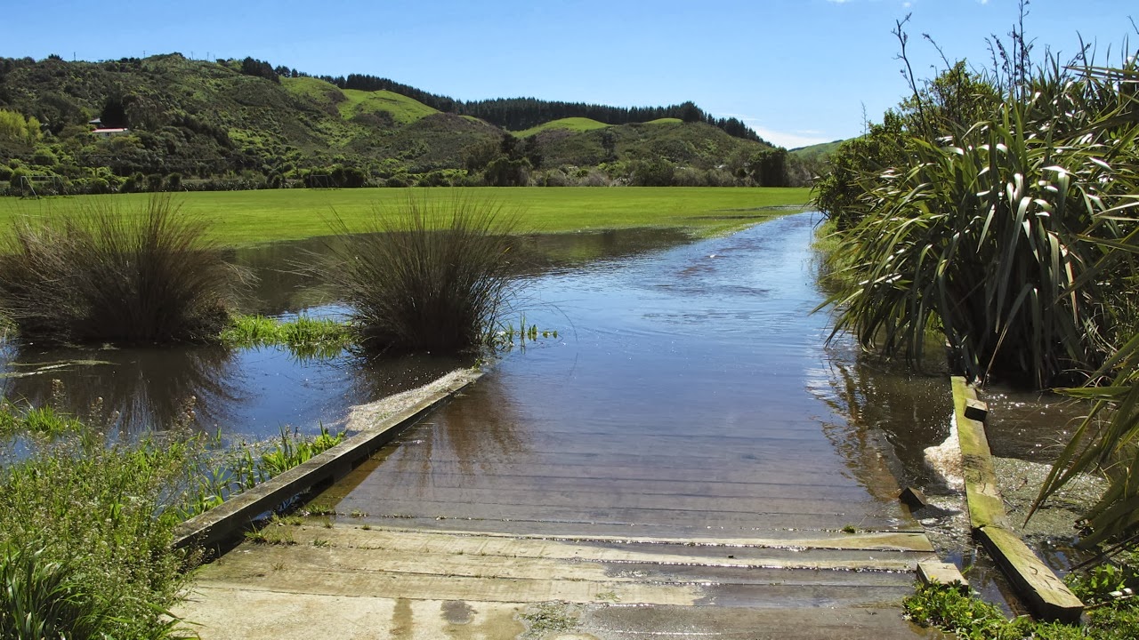
On the way up to the start of the trail, we sidetracked for a bit to the Te Marua Twin Lakes look-out. These lakes are the reservoirs for Wellington’s water supply. It was good to see them both full to the brim, as one of them was empty for repairs during last summer’s drought, which was very inconvenient. We were also interested to see that both lakes had a sealed track right around them – perfect for cycling, it would seem – and we thought we might try these later on. However, that was not to be, as when we got there, we found signs denying access to “unauthorised persons”.


Te Marua Twin Lakes

The access road to the beginning of the Rimutaka Rail Trail is quite horrible. It is very uneven, patched and broken up tarseal, and full of potholes. I was glad I didn’t have to bike that. We were surprised at the large number of cars in the carpark, considering it was a weekday. They turned out to belong to a large group of (retirement-age) walkers, whom we met along the way.

The trail itself is protected by a locked gate, with just a narrow gap for walkers and cyclists to go through – a bit tricky to manoeuvre through with a bike, even little folding bikes like ours.

The narrow gap is a bit tight for a bike (photo by John)

For the first two-thirds of the trail, the incline is almost imperceptible. In fact, it is very deceptive. The track looks like it is going downhill, but it feels like it is going uphill. Very odd.

The trail’s landscape keeps changing as it meanders through cuttings in the hill, with high banks on each side of the track; and along the open edges of the hill, with nice views to green farmlands; and through areas of forest.


The trail goes through cuttings in the hill … (photo by John)


… sometimes offers views of farmlands …


… or goes through areas of tall forest (photo by John)

It is very quiet, just the twitterings of birds, and all the while, the sound of rushing water reminds us that the Pakuratahi River is somewhere below us. We are treated to occasional glimpses of the river.


The Pakuratahi River runs through this valley (photo by John)

All along the trail there are “interpretation panels” telling the story of the building of the Rimutaka Railway Line. It really is quite an amazing feat of early engineering. And to think it was all done with picks and shovels! No bulldozers or earth moving machinery back in those days.


Interpretation panels tell the story of the Railway Line

There are four tunnels on the whole trail, but on the half that we did, there was only one – the Pakuratahi Tunnel. The information panel tells us that “Bricks to line the tunnel could not be transported to the site, as the rails had not yet been laid. The resourceful contractor instead made blocks on the site from ‘pressed sand and cement’. Workers pressed 13,500 concrete blocks, which now line the arch of the 73-metre tunnel. Built on a 100-metre radius curve, the tunnel is believed to be the first concrete-clock structure in New Zealand”. I wondered how the sand and cement got there.  Carried on pack horses perhaps?

The Pakuratahi Tunnel: the concrete blocks for the arch were pressed on site (photo by John)

The tunnel is built on a 100-metre radius curve (photo by John)

We had brought torches to use in the tunnels – we didn’t know that there was only one on this side of the hill – but we didn’t really need them. We stopped a little way into the tunnel to let our eyes adjust to the dark, then carried on. Sounds are amplified in the tunnel, and we could hear someone approaching, apparently talking to a dog.

But when we came out of the tunnel, we had a big surprise. It was a pig hunter, with no less than seven dogs! He was weighed down by a huge wild boar that he was carrying on his back as if it were a backpack.

Trevor, the pig hunter, with five of his seven dogs (photo by John)

We were agog! We’d only ever seen something like that on TV. He was very friendly and didn’t mind our taking photos of him. He told us his name was Trevor, and talked a bit about his dogs. I noticed that some of them were wearing collars with little antennae on them, and he said that this way, he could locate the dogs on his GPS when they had rushed ahead and got their quarry.

Check out the tusks on that boar!


Soon after that exciting encounter, we came to a bridge. The information panel told us it was “a ‘Howe’ truss, featuring diagonal timbers and vertical ironrods”. It was the most popular style of bridge in NZ until the 1930s. This bridge was built in 1876, but after a fire in 1910 it was largely rebuilt, and restored in 2001.

The first bridge over the Pakuratahi River (photo by John)

A ‘Howe’ truss, featuring diagonal timbers and vertical ironrods

The second bridge we came to was called “Ladle Bend Creek Bridge”. It is 18 metres long, and built on a 100-metre radius curve. On the information panel, there is a quote from Ron Mitchell, who was a child living at the Summit between 1933 and 1940. He said, “My father occasionally took my sister and me for a ride on a three-wheel railway jigger. As we all sat on one side of the jigger, it had a tendency to upturn when passing around the many curves … I was always frightened of going over Ladle Bend Creek Bridge as it was rather high and had no sides”.

Today the Ladle Bend Creek Bridge does have sturdy side rails (photo by John)

From about here, the track started to become steeper. It was still not too bad, but I did have to take my gear down to 1, and it did slow me down. But the pay-off was getting to the Summit.


We made it to the Summit (photo by John)

The Summit is now a lovely wide open space, but when the railway was built, it had to be hacked out of the hill. In the heyday of the railway, there were sidings, loops, an engine shed, a signal box, a turntable (installed in 1943), an ashpit and a 15,000 gallon water tank. There were also several houses where railway workers and their families lived.

The remains of the turntable site (photo by John)

However, there never was a station building, as passengers were not expected to get off. The sole purpose of this area was for locomotives to be changed from conventional to Fell locomotives.

The Summit shelter is not a station building. It was built in 1987, when the track was opened for walkers and cyclists, and it houses displays about the history of the Summit and the trains. More information about this fascinating place can be found here and here.

Near the site of the turntable, the remains of some locomotives are on display. They are very photogenic rusting hulks, really rather beautiful in their decay.


The rusting remains of old locomotives


The beautiful textures of decay

It was so peaceful up there, in the sunshine and absolute silence, as we had the place to ourselves. I thought we should have brought a picnic and spent more time there. But we had our usual snack of apple and chocolate, and after a comfort stop (yes, there are clean, well-maintained flush toilets there!), we headed on our way back.

A perfect place for a picnic

Ooh, this was lovely – it was going downhill, and little effort was required to get us back to the Ladle Bend Creek Bridge. There we met Thane, the Park Ranger, who was installing New Zealand Cycle Trail plaques. He told us that this was the last plaque he had to put up, and it was a “last minute” job, as the Rimutaka Cycle Trail was being officially added to the New Zealand Cycle Trail this very day. In fact, he said, the Prime Minister was due to cut the ribbon for the official opening in Petone, at 4pm today.


Thane, the Park Ranger, showing the last of the NZ Cycle Trail plaques to be put up

As we talking to the ranger, we were overtaken by two women on horseback. Another way to enjoy the trail! While crossing the bridge John pointed out a large kererū (wood pigeon) landing in a tree not very far away. Then he had to stop to pump up one of his tyres, which had developed a slow leak. The kererū was not at all bothered by all this human activity. In fact, he swooped down into some shrubs near us to take a closer look. He even gave John enough time to take a photo of him.


Look at the kererū!

The kererū was quite happy to pose for John’s camera (photo by John)

Just about a kilometre from the end of the trail, John’s tyre went quite flat, and we had to stop for him to find and patch the hole. I always admire the way he can sit on his knees for ages. He would do well in Japan, I reckon. I can’t kneel for any length of time, let alone sit back on my heels like that. The good old Swiss Army knife – with every possible attachment, including some tweezers – came in handy to winkle the sharp bit of something out of the outer tyre that had caused the damage to the inner tube.


John can sit on his knees like this for ages! Note the Swiss Army knife too …

All in all, with the interesting encounters we had, and the need to fix the puncture, it had taken us nearly three hours to ride to the summit and back (22kms). It was now 2:30pm, and we wanted lunch, so we headed to the Kaitoke Country Gardens Café, a few kilometers up the road.

I must admit that it wasn’t the best coffee, nor the best quiche, I’ve ever had, but the service was friendly, and we enjoyed sitting on the terrace overlooking a formal garden. The extensive gardens beyond apparently cover 14 acres.


The terrace looks out over a formal garden

After we’d had lunch we took a walk down the hill into the gardens, where masses of rhododendrons are in full bloom. There was also a large pond fringed by swathes of yellow irises.

This is the best time of year for rhododendrons

On our way home, we diverted to the Te Marua Twin Lakes, with the intention of cycling around their perimeters. But as I mentioned at the top of this blog, that did not work out, as it was restricted territory.

So, home we tootled, thinking we’d had a pretty good day. But it wasn’t finished yet, because it was nearly four o'clock when we got close to Petone. And the Prime Minister was about to open the Rimutaka Trail at 4pm, wasn’t he? Well, we thought, let’s go and check it out. Not that we are fans of politicians and their photo opportunities, but this was definitely something different for us.

We knew it was happening in Petone, but we didn’t know where. We drove along the Esplanade, and sure enough, near the Settlers Museum, there was a marquee. “That’s where it will be”, we reckoned. We turned around (at an appropriate place, of course) and parked. We thought we’d just have a nosey, and go away again. But people were milling about in the marquee – some wearing suits, others wearing cycling gear – and nobody objected to us being there, so we stuck around when people were invited to take a seat.

A lectern was set up with the Rimutaka Rail Trail logo, and soon the gathering was being addressed by a Māori Kaumātua, then by various representatives of local and regional councils who’d had an interest in creating the trail. The best speaker was a very enthusiastic young woman, Ash Burgess, who runs Bike Wellington, a mountain biking tours business, and who extolled the virtues of Wellington as “the coolest little mountain bike capital in the world!”.

Finally the Prime Minister, John Key, was invited to speak and cut the ribbon to unveil the sign that was to be installed on the Petone foreshore.

The unveiled sign

As people filed out of the marquee, everyone was handed a very attractive water bottle printed with the cycle trail logo, and containing not water, but a couple of Whittaker’s chocolate mini slabs (yay, my favourite!). A pamphlet with a map and information about the trail was wrapped around the bottle.

With my scrapbook in mind, I thought I would love to score a piece of the ribbon which had been handed to John Key after the cutting. I was plucking up my courage to go and ask him for it (only in New Zealand can some nobody sidle up to the PM like this without getting stopped by bodyguards!), when I spotted the ribbon discarded on a chair, so I untied the short end from the bow, and took it. I was sooo chuffed!

Then we followed the crowd outside where the photo opportunity was in full swing. In my euphoria about the scored ribbon (small minds get a thrill out of small things!), I found it hysterical that here were all these photographers with their impressive cameras and big lenses, and here was little old me in amongst them, taking pictures of the PM and the bigwigs, with my little hot pink point-and-shoot camera … It still makes me laugh as I write this up.


The photo opportunity: John Key and David Bassett, Deputy Mayor of Lower Hutt

Of course somebody convinced John Key to take a bit of a ride on a borrowed bike for the photographers. The bike happened to belong to Wellington’s cycling mayor, Celia Wade-Brown, who had cycled to the event. We were walking past as she took it back from him, and I noticed it was an electric bike. I asked her about it, and she said, "yes, it makes it easier to battle against the ferocious Wellington winds". Genius! Or would a purist say it was "cheating"?


The PM riding the Mayor's bike

Later I saw the online report of the event featuring a photo of the PM on a bike, and quite a few grumbly people had commented on the fact that he didn’t wear a helmet. But to be fair, he only rode about 20 metres, on the foot/cycle path. Hardly a dangerous act, but I guess some people just delight in griping.

We drove home in high spirits, with me still chuckling over the cheek of us “crashing” the party (but not really, because it seemed to be open to anyone who wanted to be there). We’d had a great day, a real “only in NZ” sort of a day – what with meeting a pig hunter, chatting to the Park Ranger, learning about some of NZ’s pioneering history, and getting up close, and almost personal, with the PM!


Our “booty” of water bottles, pamphlets and THE ribbon! (photo by John)


Monday 21 October 2013

Dancing, biking, and more dancing!

Yesterday, Saturday 19 October, was a very physical day. I danced for three hours in the morning, went for a two-hour bike ride in the afternoon, and went to a dance in the evening (more than three hours dancing, plus helping with the tidy-up afterwards). The anti-inflammatories got a good work-out!

As some of the readers of this blog will know, I am very keen on Scottish Country Dancing (SCD). I just love it! It’s a fun way to keep fit, and it is also great exercise for the brain – there’s a lot to remember if you want to do it well. I belong to two local clubs, which means dancing at least twice a week. I also attend most of the social events put on by the SCD community in the Wellington region. And I take advantage of any learning opportunities that are going.

One such learning opportunity happened yesterday morning. I was “stooging” for a group of candidates for the SCD Teachers Certificate, who are due to sit their final exams at the end of the year.

“Stooging” is a funny word. One of the definitions of “stooge” in the NZ Oxford Dictionary is “a person used as an instrument by or for someone behind the scenes”. I’m not sure it quite describes what stooging involves in the SCD sense, but in this context it means being part of a class for aspiring teachers to practice their teaching skills on. This session was a dry run for the exam.

For the candidates it means having a lesson plan, which involves teaching some step practice to a group of intermediate dancers, then teaching two formations by breaking them down into their elements, and teaching a dance which joins those two formations together. They have 40 minutes to do this. They are then assessed and given feedback by experienced teachers.

For the “stooges” it means a wonderful learning opportunity, as well as quite hard work. There were four candidates, who all taught different formations and different dances. It is great to be reminded of some of the finer points of SCD such as foot, hand and arm positions, rhythm, eye contact, and “covering” with other dancers in the set.

While dancing socially, many dancers don’t worry too much about dancing perfectly. They just concentrate on getting the formations right and on being at the right place at the right time (a skill in itself). They just enjoy the dance, the music, the socialising and the fun. There's a lot of laughter when things go wrong, and nobody gets upset. But it is such a treat to see dancers who dance beautifully.

The stooging went on for the whole day, but I only went for the morning session. I knew I would be going to the dance in the evening, and I wanted to still have enough oomph and “spring” in my feet to be able to enjoy that.

It would have been sensible therefore, to have taken it easy in the afternoon. But it was a beautiful day – just perfect for a ride – and the forecast for Sunday was for fine weather, but with strong gusty northerlies, not quite so good for cycling. By the time I got home from the stooging, it had started to get a bit breezy, so we thought the best place to ride would be the Hutt River trail.

We decided on the western side of the river, starting from the Ewen Bridge. At this point there is a choice between two tracks – the sealed one runs on top of the stopbank, the other on gravel nearer the water. We chose the smooth, sealed, easier one.

At the end of the stopbank, the track skirts the motorway, and you can’t see the river for all the trees at the water’s edge, as they are now fully greened up. The seal runs out at the Kennedy-Good Bridge. You duck under the bridge onto gravel, and when you get back up on the other side, it becomes a skinny, bald earth track through the grass of the Belmont Domain. Not very nice to ride on.

Past the Domain, the track disappears into a bush area, quite close to the river. It is very pretty, but I don’t like this part, as it is quite rough, and goes up and down. On last week’s ride I was able to manage the inclines (but only just!) because the surface was smooth and there was no wind. This time the roughness of the track and the wind made it much harder, and I did come to grief once, when I stalled going up the hill, and lost my balance. Luckily I fell against the bank, so no great harm done.

Stalling while struggling uphill is tricky when your pedals are in such a position that you can’t quickly put a foot out on the ground to steady yourself. I find I can only get off with my right foot, and start up with my left. Very odd. So when I stall with my right foot at the top, I keel over.

Once you come out of the bushy area, the track widens, and smooths out somewhat, but it is still gravel.

Emerging from the bush, the track smooths out (photo by John)

The track meanders between the river and the motorway, separated from one or the other by trees. At times it is quite close to the road. Away from the road, there was a lovely smell of freshly mown grass in some places, the smell of onion weed in others, and swathes of buttercups and little daisies in the unmown grass in yet others areas. Birds were twittering in the trees, and we saw the occasional butterfly.

Swathes of buttercups and daisies in the grass (photo by John)

The headwind had become quite brisk, and combined with the gravel surface, it made pedalling quite hard work. When we got close to Manor Park, the Hutt River trail comes to a ‘temporary’ end. There is a sign saying that the trail continues some kilometres further up the road, but to get to it you have to ride on SH2, which we don’t want to do. I was ready to turn around by this stage, but John wasn’t, so we explored a bit further across the railway line, into the suburban area of Manor Park and as far as the golf club (which occupies all the land between the two ends of the trail, and is the reason for the gap).

Along a nice flat stretch on the return trip, John asked me to backtrack a hundred or so metres so he could film me pedalling towards him. He wanted to use the video function of his camera, and get some practice using the camera stabilizer he has made. I won’t put the film onto this blog (it’s not very exciting), but you can read all about the stabilizer on his website. Warning: it’s a bit technical!

This is where John wanted me to film me pedalling along (photo by John)

We avoided the bushy and grassy track by the Belmont Domain, and returned by the residential streets – Owen Street and Norfolk Street – until we got to the Hardwick-Smith Lounge, which is a community facility. Next to it is a Rhododendron Dell, and quite a few of the rhodos are in full bloom right now. We didn’t go in to explore the dell, as we couldn’t go in there with the bikes, but John took a photo of one of the small rhodos at the edge.


At the Rhododendron Dell in the Belmont Domain (photo by John)

From here, rather than going back under the Kennedy-Good Bridge, we went across it, and rode on the smooth track along the eastern bank. When we got to the Melling Bridge, we crossed back to the western bank to get back to the car. We had ridden 23 kms, in two hours. That now brings my total since March to just over 700 kms. Not too shabby, eh?

I was pretty tired when we got home, and I zizzed off in a comfy chair for a short while before heading off to the evening’s dance.

The dance was a “New Dancers’ Celebration”. There are twelve SCD clubs in the Wellington Region, and this dance is a yearly event for all the clubs to celebrate their new dancers. It is an opportunity for this year’s beginners and more experienced dancers to get together, and introduce the new dancers to the joys of social dancing.

This year, the Johnsonville Club, of which John and I are members, was hosting the event. We should have been helping with setting up the hall in the afternoon, but went cycling instead. Fortunately we have a lot of new dancers in the club this year, so there were plenty of willing hands to help. And we did stay behind to help with the tidy-up afterwards.

Some of our very keen new dancers organised a “bunting bee” to make bunting (strings of flags) from tartan fabrics, to decorate the hall. Another new dancer made delightful little corsages for all the teachers, musicians, and committee members.

Debbie and Lee, the bunting bee queen bees (photo by John)

There was a great turn out, with over a hundred people attending. The hall was fairly overflowing with dancers. Many of the men wearing kilts, of course, and the women all dressed in their glad rags too, some of them wearing tartan sashes. As you can see in the photos, women outnumber the men, but that doesn’t worry us.

The first dance of the evening – The Kingston Flyer (photo by John)


The Illabo Rant is danced in a “square set” (photo by John)

As you can see in the above photo, there are several quite young people there. Scottish Country dancing is wonderful for both young and old (or should I say “not so young”) to get together to have a great time.

There was a formal part to the evening, when the Wellington Region President, Elaine Laidlaw, presented medals and certificates to some of the youngest dancers. The JAMs, as they are known (Junior Associate Members), range in age from six to nineteen, and are given the opportunity to take their medal tests. This year, nine Wellington JAMs gained medals ranging from bronze to gold. To see how well these youngsters dance, you can watch this video, taken at a recent JAM camp, in Christchurch. They are a credit to their teachers.

Johnsonville SCD Club’s teacher, Rod Downey, had prepared a great programme of dances, and briefed all the dances during the evening. The music was provided by Lynne Scott and Associates (in this case Lynne on violin, Jean Malcolm on keyboard and Richard Hardie on double bass). And the club’s secretary, Pat Reesby, who is also a keen photographer, took videos of the band and of some of the dances, which you can view here

The important people, from left:
Rod (teacher and MC), Pat (secretary, up on a chair, camera in hand), Lynne, Jean and Richard
(photo by John)

The dance finished just after 11pm. Having danced all 18 dances, I was pretty well “knackered”, and my feet were feeling just a mite the worse for wear (blooming sore, actually). But I’d had a great time, and I'm sure everyone else had too.

Finally, along with a bunch of club members, we helped to tidy up the hall – remove the decorations, put all the chairs away, help the musicians take their gear out to their cars, and sweep the floor. The wonderful kitchen crew (Elizabeth, Jean and Priscilla) had already cleaned up the kitchen after supper. All that remained was for us to take the plants, that had been used to define the band’s area, back to Rod’s home, as his car was already too full of other paraphernalia.

Home, shower, panadol, sleep!


Sunday 13 October 2013

Ara Harakeke

Today, we managed to get a great ride in, between two lots of rather heavy rain. The last few days have been pretty wet, and when I heard the rain clattering on the roof as I went to bed last night, I didn’t think we’d get to ride today. But we did. Today was sunny and calm, and even warm enough to take my jacket off. However, we’d only been home an hour or so after our ride, when we had another heavy downpour and thunder. We were glad we didn’t get caught out in that!

In view of the recent rain, we figured we’d better choose a sealed track, and so we decided on Ara Harakeke, the track that runs alongside SH1 from Plimmerton to Pukerua. We parked outside the Plimmerton railway station, ducked under the underpass, and tootled off onto the sealed path alongside the Domain. But, woah! We came around a bend in the track and found ... a lake!

A “lake” on the track! (photo by John)

A quick turn-around to an alternative route led across a bridge over a very swollen stream. This took us to the entrance of the Palmers Garden Centre, in front of which is a large display of Big Mac Slabs Furniture – beautiful garden furniture made from thick slabs of timber. It looks like a garden café, but there’s not a coffee cup in sight anywhere!

We crossed a very swollen stream


Not a cafe setting, but a display of garden furniture!

We rode up Ulric Street which winds through the Plimmerton Industrial Park, from the top of which there is access to the Ara Harakeke Way. It was glorious to pedal along the flat part of the track, and to see flowering broom, swathes of wild purple daisies, and even the delicate white blooms of some early flowering manuka.

Early-flowering manuka

I love it when the purple daisies cover whole hillsides on one side of the motorway, and when the manuka on the other side is in full flower, so that it looks like it’s been snowing. And at this time of the year, the hills in the distance look so soft and such a rich green, like a rumpled velvet counterpane. So beautiful!

Flowering broom and purple daisies, and velvety hills (photo by John)

Before long, we reached Whenua Tapu, from where the track started to climb. To begin with, it runs right next to the motorway, although elevated above it, then it goes through a bushy area which is really pretty.

A pretty bushy area, before the track becomes much steeper (photo by John)

The track became quite steep, but I was determined not to be a wuss this time. I was going to give it my best shot. Most of the way, I did OK. I used my lowest gear, and tried to just keep my legs pumping, while keeping my upper body as still as possible to conserve energy. It seemed to work in all but the steepest bits, where I still had to get off and walk. My legs just couldn’t do the worst of it, and the loading on my heart was just too much (I have a slightly leaky heart valve, which doesn’t help).


It was a struggle up that hill, but I made it! (photo by John)

BUT … I got to the bridge over the railway line at Pukerua without getting grumpy, and I felt pretty chuffed about that.


The bridges over the railway line – one for walkers and cyclists, the other for SH1

At the top of the Pukerua hill there are a few shops, and as always when we go past there, I shuddered at the sign advertising “Le Mer Day Spa”. The French word for “sea” is a feminine word, so it should be la mer, not le mer. And being a picky linguist, it makes me cringe every time I see it.

 
Aargh! It should be La Mer, not Le Mer!

Having reached the shops, we considered stopping for an icecream, but then decided not to. We turned around and whizzed down the hill back to Plimmerton. Wheeee!! Fabulous, the free-wheeling speed, the sun on our backs, and the wind in our hair! Oops, sorry, I just got a bit carried away there. Of course we didn’t have the wind in our hair, we were wearing helmets – but it sounded good …

When we got back to the Plimmerton Domain, there was a group from the local archery club practicing their skills. We stopped for a while to watch them. The bows are quite seriously sophisticated looking instruments. When I commented that it was something I would have been quite interested in learning when I was younger, a man in his fifties came over and said it was never too late to learn anything (I'd agree with that!). Lots of older people were wanting to learn, he said, but there was quite a waiting list to join the club.


Plimmerton archers and their targets (photo by John)


Modern-day archers


Back to Plimmerton, under the station underpass. I was quite taken by the cheerful murals in the tunnel.

Symbols and sights of Plimmerton in the station underpass


A tile and mosaic mural of the seashore in the station underpass
 
We rode past our car, and carried on towards Paremata, where we were planning to have lunch. We popped into a little side street for a look at the beach, which wasn’t there, as the tide was in, and waves covered the whole beach.


The tide was in at Plimmerton Beach (photo by John)

I thought the seats overlooking the beach were rather attractive – made of concrete, but with an artistic touch of paua. Concrete does not have to be ugly, it can be rather beautiful when polished up.


Artistic seats

We rode along the southernmost part of Ara Harakeke, between the water and the railway line, towards Paremata. At Mana Station we went through the underpass – no decorations here – and doubled back towards “Ruby’s”, a café with a nice courtyard, where we had a very satisfying lunch.


Lunch at “Ruby’s” (photo by John)

We still hadn’t had enough of cycling, so after lunch we kept going through the Ngatitoa Domain and Mana Yacht Club. Lots of yachts and pleasure boats were moored at the marina, but out towards the bridge, two fishing boats were anchored off the shore. One of them had an impressive array of masts and tackles and machinery on board, for what was actually quite a small boat.


Fishing boats anchored near the Paremata Bridge (photo by John)

Here we turned around and biked back, through Mana, and Plimmerton, past our car again, and along the foreshore at Karehana Bay. On previous rides in this area we had gone past the boating club at Karehana without stopping, as the gate across the driveway is usually closed. But this time John found a path around the side of a building which allowed us to go onto the wharf, from where there is a great view out towards Mana Island.

Mana is a strangely flat-topped island, which was a base for the Māori chief Te Rauparaha in the 1820s. A decade later, European settlement started there with a whaling station and later, sheep farming. These days the island is administered by DOC (Department of Conservation).

Mana Island (photo by John)

By now a brisk headwind had sprung up, and I thought to myself “this is good practice for when – if! – we get to ride in Holland (where the wind is ever present)”. Taking John to Holland to do some bike touring is one of the items on “my bucket list”.

When we got to the Hongoeka Marae sign, we turned around and rode all the way back to the car on the road, rather than on the foot/cycle path. This was easier, as, being the weekend, there were quite a few people walking on the footpath. Also, I need to extend my “comfort zone”, by riding on the road, rather than dedicated cycle paths, more often.

What with all this riding back and forth, we had managed to cover 25 kms by the time we got back to the car. On the way home, I noticed that the “Prestige Caravans” yard on the corner of Acheron Road had a lot of their caravans and motorhomes open for viewing, so we stopped for a nosey.


$125,000 worth of motorhome! (photo by John)

I love looking inside caravans or motorhomes. I think it would be rather fun to have a holiday in one, even though I’m not a fan of camping. It is quite amazing what they manage to fit into such a small space. All the ones we looked into had not only fully functioning kitchens with stove, microwave and fridge, but also had TV sets, and a toilet and shower squeezed into the tiniest of spaces. That is the main thing that puts me off camping – the fact that you have to tramp across a paddock to get to the ablutions block! Not much fun in the middle of the night, or in the rain!


Inspecting the top bunk (photo by John)

I remember the first time I ever saw inside a caravan. I was nine years old, and we were visiting a Home Show. At the time, my Mum, my sister and I were living in my grandmother’s house along with my uncle’s family and it was all a bit cramped. There was a severe housing shortage in the Netherlands in the 1950s, and a caravan seemed like some sort of solution. We kids thought it was a great idea. But I don’t think Mum did, as we ended up moving into another family’s attic not long after. A great move, as it turned out, as we had a fantastic year there, and our two families became great, lifelong friends.

Having decided that we were not going to sell the house, and we were not going to buy a motorhome, and we were not going to become “grey nomads”, we got back into our little car and drove home, feeling very satisfied with our day.